
TL;DR: Salt Lake has major construction popping up along a route that would make suspiciously good sense for an underground network connecting Temple Square to Granite Mountain. Coincidence?
Unfortunately, I have the kind of brain that is programmed for pattern recognition. So I’ll post this as a hypothetical / pattern-recognition exercise, not as a claim that I’ve uncovered proof of this. But IYKYK
I grew up in Salt Lake City and moved back in January 2026, and over the last eight months I’ve noticed some weird stuff. Obviously the SLC Temple has been under construction for years for the upcoming “rapture” and earthquake that I was taught as a child could be coming any day. But there are multiple major construction sites running through locations that, geographically, could function as nodes along an underground corridor through the Salt Lake Valley.
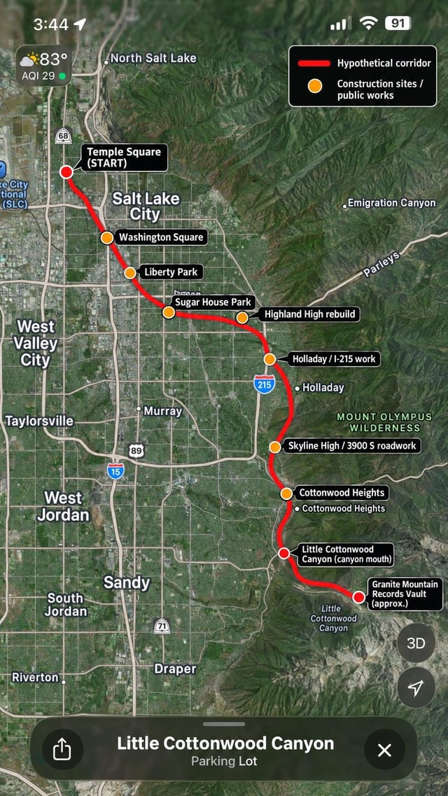
So I made a map showing what I mean.
The thing that initially sent me down this rabbit hole was Temple Square, but also the fact that I know quite a lot about hidden history and when I moved back here, certain buildings just look insanely out of place. I’ll list them at the bottom for anyone interested. The important piece to this is that there are records the LDS church doesn’t want exposed about Brigham Young finding existing buildings in salt lake among other places, and had a secret arrangement with the US government to let them know about sites he found to keep the lie going. Super sus guy all around.
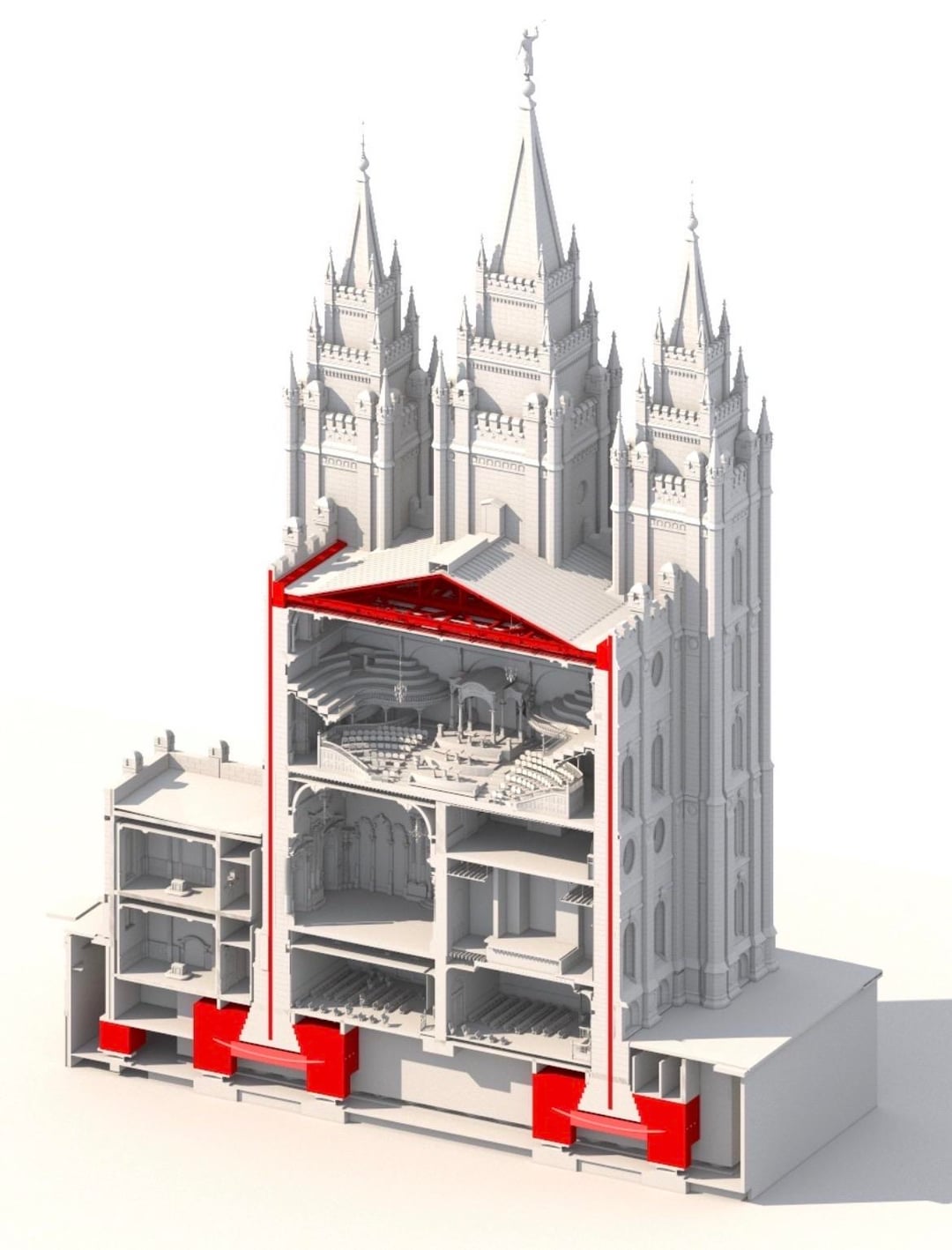
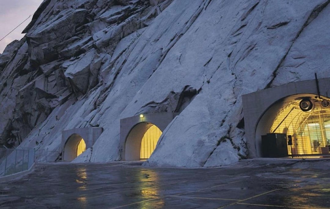
The Salt Lake Temple has just undergone a huge seismic reconstruction. After more than six years of work, the temple now rests on 98 base isolators about 20 feet beneath the structure, allowing the entire building to move independently during an earthquake. The Church announced in June that the weight transfer was complete and the isolation system was active. Once I started looking at the geography, I started wondering about the underground infrastructure around it. So The LDS Church also has the very real and super bizarre Granite Mountain Records Vault built into Little Cottonwood Canyon, containing billions of genealogical images and other records. The Church openly acknowledges it exists. But nobody is allowed in. So my hypothetical question became: if Salt Lake (the church) decided to build a larger hardened underground network, what route would actually make geographic sense between downtown, the eastern valley and the Cottonwood canyons? That’s where the construction pattern got interesting to me and got me suspicious.
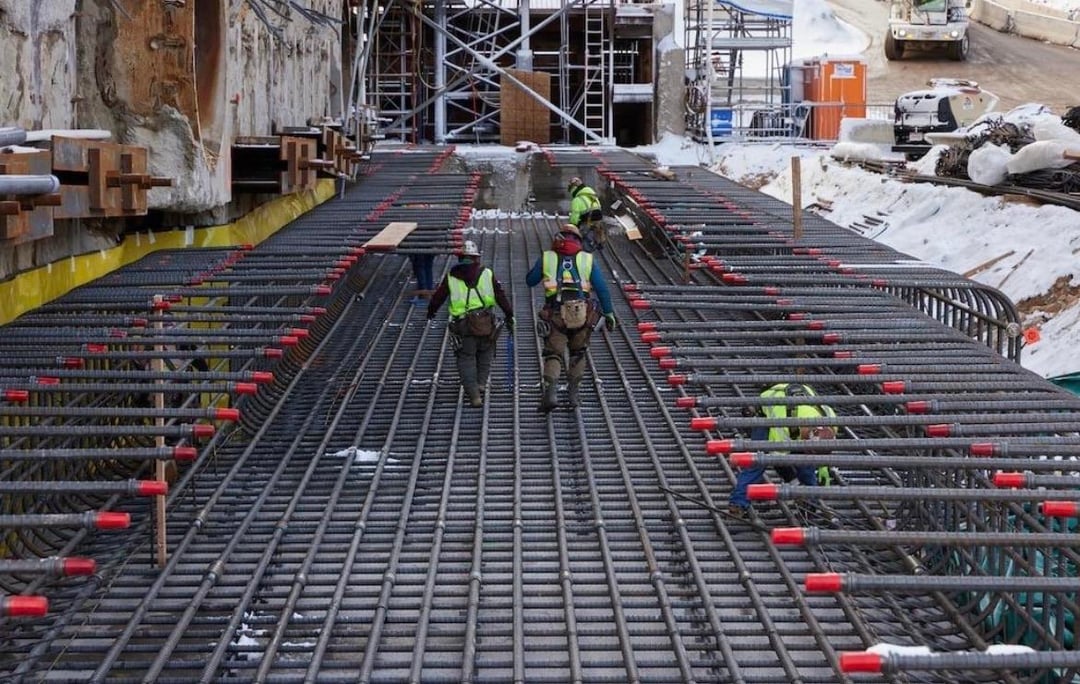
Since returning in January, I’ve personally watched major construction happening around several points along that general corridor — Temple Square/downtown, Liberty Park, Sugar House, Highland High School and other east-side areas. These projects all have perfectly ordinary public explanations. Highland alone is a publicly documented $300 million rebuild expected to take roughly four years, and Liberty Park has several documented projects underway, including lake dredging and other infrastructure work. I’m not claiming those explanations are fake. I’m also not claiming they’re the full truth. These large legitimate on paper construction projects would be the easiest places to conceal much deeper underground work, because excavation equipment, concrete trucks, road closures, utility relocation and constant construction traffic would already be expected and nobody would raise an eyebrow
Then we have to tie in the water history. Early Salt Lake actually had a really impressive network of waterways. City Creek and other Wasatch streams were diverted through irrigation ditches and canals throughout the city, and historically those waters ultimately connected through the Jordan River system toward the Great Salt Lake. Parleys Creek was one of several major streams that was incorporated into Salt Lake’s municipal water system. That made what just happened at Sugar House Park especially interesting to me. On August 21, the Salt Lake Tribune reported that the Sugar House Park pond and Parleys Creek were experiencing extremely low flows, with the pond becoming foul and toxic. I drove past it myself literally two days ago after having seen it nearly drained and disgusting, and suddenly the pond was full again and Parleys Creek appeared to be flowing dramatically abundantly. There may be an entirely mundane hydrological explanation for that. I’m not an expert on this stuff. But because Sugar House Park occupies land that was historically part of the Utah Territorial Prison site, and because Highland High immediately beside it is currently undergoing massive excavation and reconstruction, it caught my attention. Then add Utah’s strange current water contradiction. The Great Salt Lake remains an enormously serious environmental concern while Utah simultaneously has a huge wave of data-center development and proposals. The state issued a 2026 framework specifically requiring future data-center development to protect the Great Salt Lake and avoid increasing water consumption. BUT One proposed project places data-center infrastructure roughly ten miles from the lake. How odd.
Salt Lake is unusually earthquake-vulnerable. Or so we’ve been told. I’m not an earthquake expert whatsoever so idk but I have my suspicions about how much it’s been dramatized. The headquarters of one of the wealthiest and most institutionally established religious organizations in the world sits here. That organization already has hardened archival infrastructure inside a mountain for Christ sakes. Its centerpiece downtown has just undergone an extraordinarily sophisticated seismic retrofit involving major underground engineering.
And then, an unusual amount of excavation, rebuilding, water infrastructure work and large-scale construction is happening across the valley.
So here’s my conspiracy hypothesis:
I think it’s entirely possible that some of these sites are nodes in a much larger underground infrastructure project. So
I mapped the route that would make the most geographic sense to me, and the number of current construction sites sitting near it is weird enough that I wanted to throw it out to people who enjoy investigating this kind of thing.
WEIRD SITES THAT DON’T FIT THE PIONEER SETTLEMENT STORY:
Washington Square: it looks super “old world” to me, there’s literally a statue of Columbia at the top, and it’s the Salt Lake City and County Building. It kind of looks like a mini Big Ben. It’s Richardsonian Romanesque, and looks medieval. It doesn’t make sense.
Sugar House Park: The Utah Territorial Penitentiary was (supposedly) authorized in 1853, completed in late 1854, and opened in 1855. Again, kind of weird architecture for the time. It stood where Sugar House Park and part of Highland High are today. It eventually became a huge, fortress-like stone prison. Friends I had who went to Highland said the school definitely did have underground tunnels.
Old Mill: At the mouth of Big Cottonwood Canyon. That one dates to 1883–84, was built largely of granite reportedly discarded from the Salt Lake Temple construction? Yeah okay. A fire gutted it in 1893 (surprise!) leaving the massive stone shell. It’s still there today, it was a “haunted” place we liked to go to in high school but now the structure has been condemned for seismic concerns and isn’t open to the public anymore
And that’s just a few of them
Posted by Relative_Bluebird841
1 Comment
Knowing da mormons i wouldnt be surprised