
What If Atlantis, Lemuria, and Hyperborea Were Never Lost. Just Removed From Maps?
We were told Atlantis, Lemuria, Hyperborea, and the lands beyond Antarctica were just myths. That they sank or never existed. But when you start stacking the real anomalies — sonar maps, sealed flight paths, magnetic drift, ancient charts, GPS glitches, military lockdowns, satellite blackouts — it stops sounding like legend.
These places existed. They still do.
They’ve just been taken off the board.
This is a working theory. I’m not done putting the pieces together. But there’s enough here already that it can’t be coincidence. I’ll lay it out simply.
⸻
Atlantis
Plato said it was beyond the Pillars of Hercules. That’s the Strait of Gibraltar today. The center of the Atlantic Ocean. Right where the Mid-Atlantic Ridge sits now. It’s raised. Flat in places. Stepped in others. Not the shape of a normal tectonic plate. Looks more like buried architecture than geology.
You can’t fly direct from Brazil to West Africa. Even though it’s the shortest line. Planes always arc far north or far south. Right in the middle of that gap is Bouvet Island. Norway controls it. Covered in ice. No residents. No travel. Listed as a “nature preserve.”
Older maps show land right in that stretch. Real cartographers. Not fringe stuff. Oronce Finé. Mercator. Piri Reis. Their maps showed continents that don’t appear anymore. Some even called it Atlantis.
The Sargasso Sea is in this zone too. Strange currents that trap ships. Magnetic drift. Stalled navigation. Bermuda Triangle activity happens just west of this. Ships and planes vanish. No signal loss. No debris. Just gone.
Undersea cables route around this ridge. They could go across. They don’t.
Satellite scans are cut, stitched, looped.
Sonar is partial or degraded.
Someone’s keeping eyes off this zone.
⸻
Lemuria
Tamil records call it Kumari Kandam. A massive continent that connected southern India, Madagascar, and part of Australia. Polynesian and Aboriginal histories describe something similar. Geologists don’t talk about it, but the Mascarene Plateau and Chagos Ridge line up exactly. Looks like an underwater land bridge.
Diego Garcia sits dead center. Nobody lives there. It’s leased by the UK to the US. Full military lockdown. Locals were removed years ago. Nobody gets in. Nobody flies over. Official reason is defense. That’s always the reason.
Try to book a flight from Darwin to Madagascar. Or Perth to Sri Lanka. They route way out of the way. Hundreds of miles of extra flight time. Planes that pass nearby sometimes vanish from radar. Then show back up like nothing happened.
Catherine Austin Fitts has said this area is part of the black budget world. Off-grid aerospace. Logistics hubs. Maybe even launch points. A breakaway system with its own infrastructure.
Flight MH370 was last seen heading straight toward this zone. No wreckage. Logs sealed. Trajectory fits. Nobody talks about it.
The satellite imagery here is blurry. Sonar is incomplete.
The surrounding islands are run by France, the UK, and the US. All off-limits. All labeled protected. But not explored.
⸻
Terra Vista
In 1946, Admiral Byrd led Operation Highjump. The US sent over four thousand troops to Antarctica. Tanks. Aircraft. Warships. Said it was for research. But it moved like a full military mission.
The operation ended early. Aircraft were lost. Byrd gave an interview in South America afterward. He said there was a threat. Fast craft. Polar to polar flight capability. That quote was buried. The footage is gone.
Three years later, the Antarctic Treaty was signed. It banned everything. No private ownership. No independent research. No commercial activity. Still enforced. Never broken.
Bouvet, Kerguelen, Macquarie, and other outer ring islands are locked. No access. Controlled by NATO-aligned countries.
Satellite images of Antarctica are stitched. Looped. Blurred. Google Earth glitches out at the poles. GPS testing is “ongoing” in those regions. Governments have admitted it.
Project Iceworm was real. The US tried to build nuclear silos under the Greenland ice sheet. It didn’t work. But they tried. That tells you everything.
Some maps before 1900 show land beyond the southern ice ring. Now they don’t.
⸻
Hyperborea
In Greek, Norse, and Vedic records, Hyperborea was a circular landmass at the North Pole. Ringed rivers. Central mountain. Mercator mapped it in 1595. Four quadrants. Magnetic axis at the center.
Now the North Pole is just ice. No land. No flights cross it. No direct route over the top of the planet.
The magnetic pole is moving fast. Toward Siberia. Planes avoid the drift zone. Military bases are stationed around the Arctic Circle. Both the US and Russia.
GPS and radar don’t work right up there. Governments confirm this. Satellites glitch. Civilian travel to the exact pole is redirected or blocked. Travel packages get close but never reach it.
Hyperborea didn’t sink.
It just vanished from access.
⸻
Other Places That Don’t Add Up
Zealandia. A submerged continent near New Zealand. Scientists admit it’s real. But no one explores it.
Sundaland. A lost land beneath Southeast Asia. Matches dozens of flood myths.
Bermuda Triangle. Still active. Still no real explanation.
Cables don’t cross these zones.
Satellites cut out.
Sonar is always partial.
The CIA ran Stargate. Remote viewing sessions targeted Antarctica. Reports said sealed structures. Ancient. Not human. Under ice.
Bases like Diego Garcia and Pine Gap are near these zones. Off-grid. Underground. No oversight.
GPS is jammed or tested near every one of these.
⸻
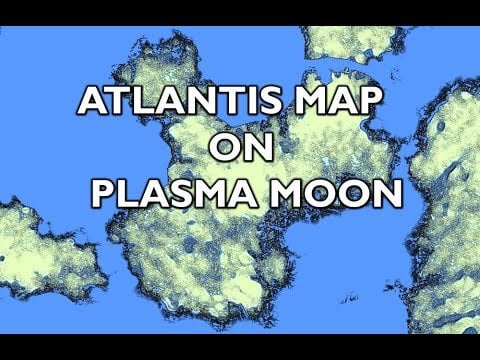
The Moon Map
Some researchers say the dark regions on the moon match these landmasses. Inverted. Mirrored. Lemuria. Atlantis. Hyperborea. Terra Vista. You can see it. I’ll post a link that shows it better.
I don’t claim to know how or why. But it’s real. Something is being shown there.
⸻
So What Really Happened to These Lands
They weren’t destroyed.
They didn’t disappear.
They were hidden.
Sealed with treaties
Blurred by satellites
Blocked by radar
Masked by GPS drift
Removed from maps
Written out of schoolbooks
Labeled myth
They’re still here.
We’re just not allowed to go.
⸻
If You’re Noticing This Too
I don’t have all the answers. But I’ve found too many overlaps to ignore.
If you’ve seen similar things — weird flight routes, map distortions, blackout zones — drop them.
Screenshots. Satellite glitches. Flight trackers. I’m building.
Posted by bluesjean
1 Comment
Interesting ideas/theories and interesting YouTube channel. 🙌👌
I had a strange experience on flights to/from the west coast of the US to/from Asia. It was a super late night/early morning flight on a huge double decker plane.
I always book window seats because I like looking outside. They dimmed the cabin lights and told us to close our window shades so people could sleep.
As we were flying over the ocean, I opened my window shade just a bit to look out and out of nowhere, a flight attendant runs over to reprimand me and tell me to close the shade because people were trying to sleep.
I opened the shade a couple more times and same thing happened, no flight attendants in sight and then all of a sudden they appeared, running over to tell me to close it.
Just struck me as super strange because it was completely dark outside, aside from some strange lights down on the ground or in/on the ocean below.
I don’t think we were passing over any mapped islands so who knows what it was but the flight attendants suddenly appearing, running over and kind of freaking out was strange. 🧐